How did these maps come to be In 1994 I received a copy of the B10 box with the canon 3 mil hex map. I desired to expand this map and in 1995 I created these. I finally released these old hand-drawn maps in 2017
Http://www.pandius.com/Threshold_21_Marilenev_Estate_Map.png of Threshold 21 page 192 by Allen palmer based on work by Sean Meaney and Sturm Conflicting areas seemed minor...in the beginning. Greatest conflict thus far was the Volaga River and other rivers between he various canon sources. I lessened the ridiculous wide Volaga river. Normal flowing rivers more not than rarely have a width of 3 to 4 miles, so I reduced it to the width as X1/B10 gave, about 0.5 to 1.1 mile. It is sometimes difficult to really feel distances and sizes when doing maps. Me being Dutch and used to wide rivers can mimic this to normal sizes , and place these on the map. I scaled down to size Specularum (a very detailed measuring and calculation made Specularum just a bit more than 1 hex) Battled the contradictions of the various sources on the Volaga river; The river width, direction, pattern and even joining is varried on literally ALL the sources...none is equal to the other. As the oldest and most detailed sources...I decided to continue to follow the X1/B10 on this.
Using the Fanon History maps by Sturm, Simone, Agathokles
Description
This (and feeling very insecure about this) is the final version of the 1 mile hex map of the Coastal Region of Karameikos. To have best view you best have to download this map.
As to the last alteration; I could resolve the following and updated the Karameikos Coast map (hopefully the final version) And now I started working on the others map canon issues for the Karameikos Central and -North maps
Ok Thanx for the Help, Sturm, Baron, Aoz, Chimpman, Shawn, Havard, Irondrake, Giulio Caroletti, Greenbrier, BokayGlenn, LoZompatore, Chtulhudrew, WingsofCoot, Philosopher-X, Bjorn WR, Allan and all others, for the detail informative help as well as the emotional support. Without You I could not have done this.
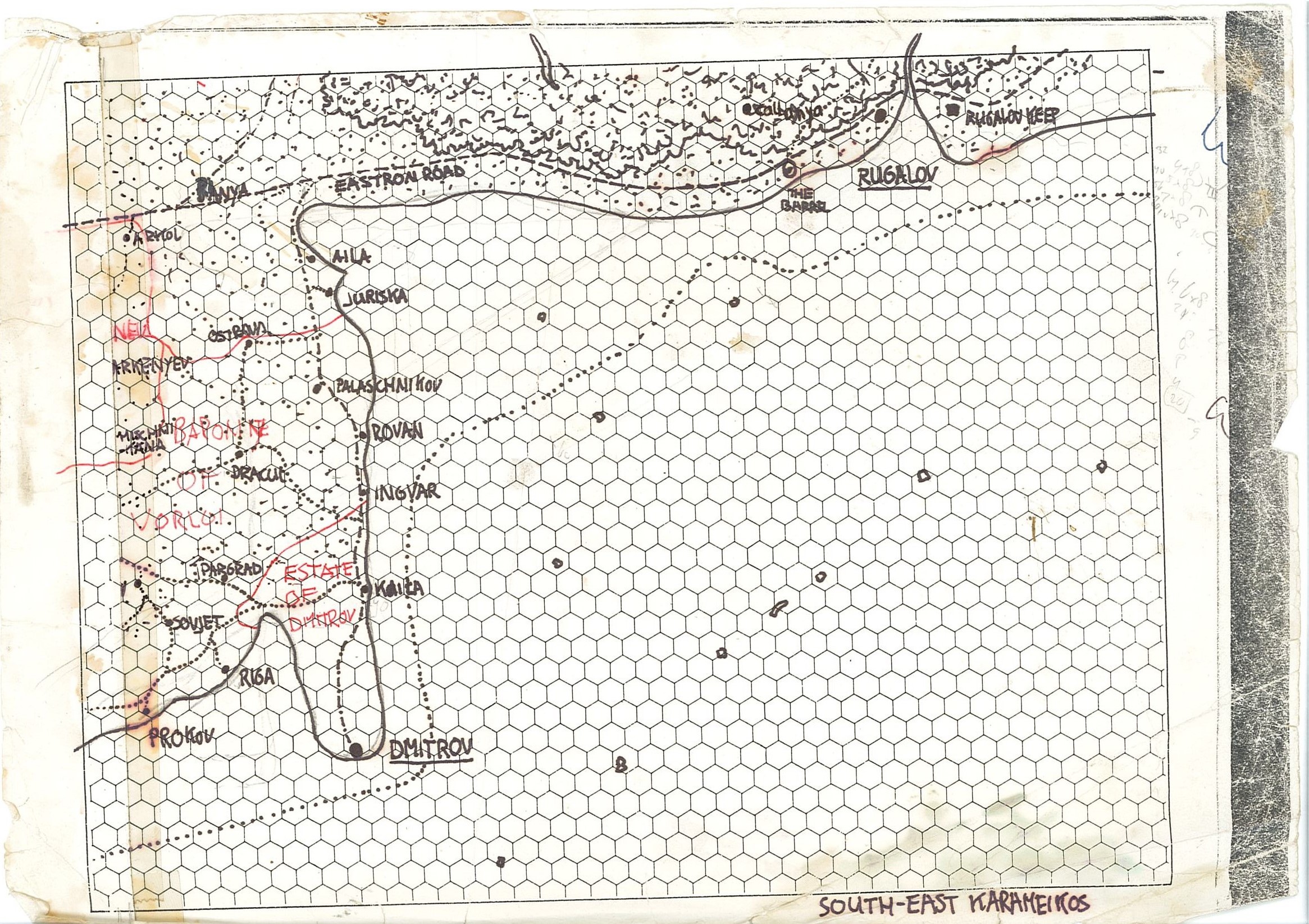
After more than 2 years of work, Karameikos slowly reaches the end of my mapping work
I began workin on this trilogy map of Karameikos 08 april 2019 and now 1044 days later, it seems today 15-Januari 2022 I have almost fully finished this map.
14-04-2020 A Dark Day I discovered the map I thus far had worked several months was flawed. It did had too many scaling, shifting, overlapping, and other forms of mistakes due all the variant canon as well as fanon sources, and some measurement mistakes I made. I decided to remove all and start over completely. Without too many reveals, I worked on the maps almost daily.
And this was the first to become released. Began Published:
Map Details Marilenev Family Castle Placed as a ruin Symbol Local Mansion/Manor Ruins in Estate of Marilenev and Torenescu are still unnamed but numbered now M1 to M6, T1 to T5, I have dated these all as Family related Mansions destroyed in the war of 970AC
Fort Doom Added escarpment of the Duum Tor Hill according the varied canon/fanon merged
Coastal Islands Named the ones unnamed and of significant size, also added minor route marks, and a few afe achoring points I had forgotten
Missing Labels Some Manors were unnamed, while clearly belonging to nearby settlements, so did this too Some Inn/Caravanseray ruins were unnamed, added these too
Missing Settlement ruins from the Threshold 12 Taymora maps Added Tarszis and Lorellin according these maps as ruins
21-08-2021 Overlapping issues (aaargh...I always battle these, and still they pop up grrr... mostly altitudes, or terrain issues. Working on 3 maps at the same time tends to enabling such flaws. grrr) So checked the whole overlapping region between Karameikos Coast and Karameikos Central, found several and readjusted (and the copied/paste the whole section to the Karameikos Central map), so the overlapping issues are now in the Karameikos Coast map fully resolved. (now to do the same with the the Karameikos North, Karameikos Central, Thyatis/Zargash Region and Ylaruam west maps overlapping areas....grrommmm) 15-09-2021 Added some forgotten mini labels(dragons, locations)
Karameikos also has grasslands, pastures, deserts. In the mountains, gradually, the forest turns in mountain pastures, scattered in various shrubs (e.g. pinus mugo, rhododendrons, junipers) and dotted with small colorful flowers. Higher up are the mountain grasslands and even areas similar to a desert because they have no or almost no vegetation (rocks, glaciers). (thanx to Wikipedia for the easy links)
There is only one still formidable task to complete; Writing down all the canon and fanon descriptions I used in the Karameikos Atlas (a name I found most suitable). This will soon be presented here as a link, and I certainly need help there to make it an easy reference guide
Did I stop here....well....no
I made many more maps. , and more I still work upon, others are planned
Some of detailed Karameikan Areas, others of other countries of Mystara
All can be found here; https://www.deviantart.com/6inchnails/gallery
No comments:
Post a Comment